GIS Analysis
How can integrated social and ecological indicators provide a more comprehensive assessment of neighborhood health and resilience in hyper-urban contexts like New York City?
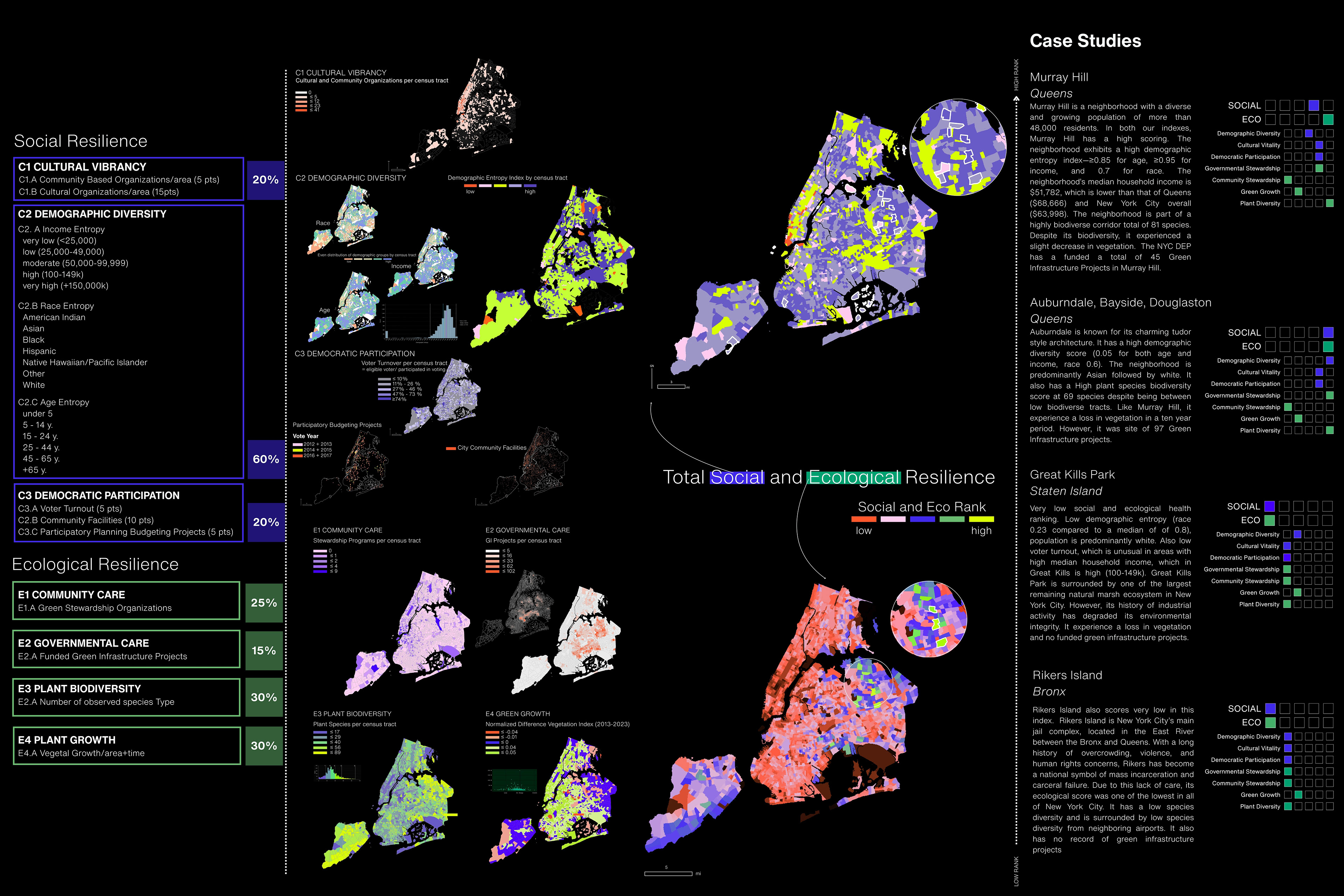
Urban health is typically approached through either clinical metrics—such as disease prevalence and healthcare access—or broad ecological indicators tied to non-urban environments. These siloed models often miss the complex interplay of environmental conditions and social life that shapes resilience in dense cities. In places like New York City, community well-being is influenced not just by pollution levels or hospital proximity, but by the vibrancy of social infrastructure, biodiversity in overlooked micro-ecosystems, and the everyday experience of public space.
This project proposes a new framework for evaluating neighborhood health by bridging ecological and social indicators at a local scale. Using New York City as a case study, this study aims to develop an adaptable, spatially explicit model that accounts for a range of forces—environmental, political, infrastructural, and cultural—that shape neighborhood vulnerability and resilience. This approach integrates both biodiversity metrics and social indicators to generate a richer, more inclusive picture of what makes urban communities healthy and sustainable over time.
Columbia GSAPP I Spring 2025 I Instructor: Jonathan Stiles I Tools: ArcGIS Pro, Python, Adobe InDesign I Collaborator: Trella Isabel Lopez