GIS analysis
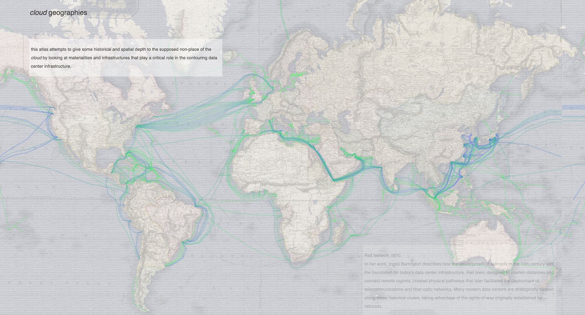
This atlas seeks to provide historical and spatial depth to the so-called "non-place" of the cloud by revealing the materialities and infrastructures that shape and define data center networks.
Data centers have emerged as one of the most critical building typologies of the 21st century, supporting the increasing demands of cloud computing, AI, and digital infrastructure. Despite their essential role, their spatial, environmental, and political implications often go unnoticed.
The project’s objective is to examine data centers as interconnected elements of urban infrastructure. Using Python to scrape and geocode data center locations, combined with GIS mapping and spatial analysis, the atlas provides a preliminary exploration of the spatial and historical dimensions of data centers, beginning with global submarine cable networks and zooming into the former mill town Holyoke in Massachusetts.
website:
Columbia GSAPP I Fall 2024 I Instructors: Dare Brawley, Mario Giampieri I Tools: GitHub, Mapbox, Python, QGIS